No. 8 | Speed Kills
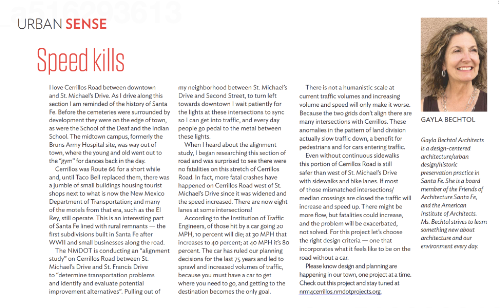
In the May edition of The Santa Fe New Mexican’s Home Magazine, I talk about the importance of choosing the right design criteria for the design and planning of our road infrastructure. Urban Sense.


Read The Article:
I love Cerrillos Road between downtown and St. Michael’s Drive. As I drive along this section I am reminded of the history of Santa Fe. Before the cemeteries were surrounded by development they were on the edge of town, as were the School of the Deaf and the Indian School. The midtown campus, formerly the Bruns Army Hospital site, was way out of town, where the young and old went out to “gym” for dances back in the day.
Cerrillos was Route 66 for a short while and, until Taco Bell replaced them, there was a jumble of small buildings housing tourist shops next to what is now the New Mexico Department of Transportation; and many of the motels from that era, such as the El Rey, still operate. This is an interesting part of Santa Fe lined with rural remnants — the first subdivisions built in Santa Fe after WWII and small businesses along the road.
The NMDOT is conducting an “alignment study” on Cerrillos Road between St. Michael’s Drive and St. Francis Drive to “determine transportation problems and identify and evaluate potential improvement alternatives”. Pulling out of my neighborhood between St. Michael’s Drive and Second Street, to turn left towards downtown I wait patiently for the lights at these intersections to sync so I can get into traffic, and every day people go pedal to the metal between these lights.
When I heard about the alignment study, I began researching this section of road and was surprised to see there were no fatalities on this stretch of Cerrillos Road. In fact, more fatal crashes have happened on Cerrillos Road west of St. Michael’s Drive since it was widened and the speed increased. There are now eight lanes at some intersections!
According to the Institution of Traffic Engineers, of those hit by a car going 20 MPH, 10 percent will die; at 30 MPH that increases to 40 percent; at 40 MPH it’s 80 percent. The car has ruled our planning decisions for the last 75 years and led to sprawl and increased volumes of traffic, because you must have to car to get where you need to go, and getting to the destination becomes the only goal.
There is not a humanistic scale at current traffic volumes and increasing volume and speed will only make it worse. Because the two grids don’t align there are many intersections with Cerrillos. These anomalies in the pattern of land division actually slow traffic down, a benefit for pedestrians and for cars entering traffic.
Even without continuous sidewalks this portion of Cerrillos Road is still safer than west of St. Michael’s Drive with sidewalks and bike lanes. If most of those mismatched intersections/median crossings are closed the traffic will increase and speed up. There might be more flow, but fatalities could increase, and the problem will be exacerbated, not solved. For this project let’s choose the right design criteria — one that incorporates what it feels like to be on the road without a car.
Please know design and planning are happening in our town, one project at a time. Check out this project and stay tuned at nm14cerrillow.nmdotprojects.org.
Gayla Bechtol received her architecture degrees from Harvard University and from the University of Southern California. Gayla Bechtol Architects is a design-centered architecture/urban design/historic preservation practice that has created designs for homes, institutions, and urban spaces for nearly 30 years. Bechtol practiced deep democracy while leading the citizens of Santa Fe to the award-winning Santa Fe Railyard. She is a board member of Friends of Architecture Santa Fe.
Related Articles
No. 28 | Urban Sense: Dreaming of a Future Optimism
In the July edition of The Santa Fe New Mexican's Home Magazine,...


